Dd Form 2993 - Environmental Baseline Survey (Ebs) Checklist Page 3
Download a blank fillable Dd Form 2993 - Environmental Baseline Survey (Ebs) Checklist in PDF format just by clicking the "DOWNLOAD PDF" button.
Open the file in any PDF-viewing software. Adobe Reader or any alternative for Windows or MacOS are required to access and complete fillable content.
Complete Dd Form 2993 - Environmental Baseline Survey (Ebs) Checklist with your personal data - all interactive fields are highlighted in places where you should type, access drop-down lists or select multiple-choice options.
Some fillable PDF-files have the option of saving the completed form that contains your own data for later use or sending it out straight away.
ADVERTISEMENT
 Checklist Printable pdf") 1
1 2
2 3
3 4
4 5
5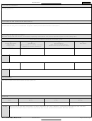 6
6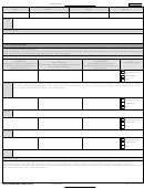 7
7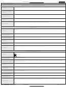 8
8 9
9 10
10 11
11 12
12 13
13 14
14 15
15 16
16 17
17 18
18 19
19 20
20Classification:
Continue
g. SOIL
(Note the types, permeability, drainage ditches, low lying areas [standing water], unusual or out-of-place mounds, disturbed areas, discolored soil, areas
unusually devoid of vegetation, and so forth. Is the area prone to sink holes? Provide 8-digit military grid coordinates of the areas identified. A global positioning
system may be used in addition to the grid coordinates.)
h. GROUNDWATER
(Groundwater is any water source present beneath the surface of the ground. What is the depth of the groundwater and in what general direction does it flow?)
i. SURFACE WATER
(What surface water is present on the site; lakes, ponds, rivers, or streams? What is the direction of flow for surface water and drainage? Indicate the direction
of surface drainage on graphics or a site map. Note any standing [nonflowing or sluggish] water.)
j. WETLANDS, FLOOD ZONES, COASTAL ZONES
(Is the site located in or near a wetland, flood zone, or coastal zone; for example, swamp, marsh, bog, or areas prone to flooding? Include the location of the
wetlands and flood zones on graphics or site maps as appropriate. Note any areas that are flooded, show evidence of past flooding or flash flooding, and any
potential wadis, washes, or dry creek beds.)
5. DETAILED SITE AND ADJACENT PROPERTY DESCRIPTION
(Make a detailed sketch or map overlay of the site, noting the areas of significance including the date, the surveyor’s name and unit, a north arrow,
scale, and legend. Take photographs and include grid coordinates and a description of both the area and reason for taking the photograph.)
Note: Everything examined in this section for the site must also be examined for all adjacent property and documented in Section 7 below.
a. DESCRIPTION OF STRUCTURES
(Describe the structures and their use: housing, maintenance, or office space. Include heating and ventilation systems and potential for Radon. Note the
condition of the materials that may contain asbestos, such as roof shingles, floor tiles, or pipe insulation. These may release hazardous fibers if damaged.
Look for signs of chipping or peeling lead-based paint. Look for electrical hazards and structural damage. Determine current and prior usage of structures.
Document water and sewer capability. Look for evidence of previous spills, hazardous materials, or waste storage. Note any chemical-type or strange odors.
Look for evidence of pest infestation.)
Tents (soft-sided structure)
Semipermanent (hard buildings without permanent below surface foundations)
Permanent (hard buildings with permanent below surface foundations)
NOTES
DD FORM 2993, AUG 2015
Page 3 of 20 Pages
Classification:
ADVERTISEMENT
0 votes
Related Articles
Related forms
 Report")
")


, Active Guard Reserve (agr), Active Reserve (ar), Full Time Support (fts), And Reserve Program Administrator (rpa) Service Members")
Related Categories
Parent category: Business