Form 600 - Application For Beneficial Water Use Permit Page 5
Download a blank fillable Form 600 - Application For Beneficial Water Use Permit in PDF format just by clicking the "DOWNLOAD PDF" button.
Open the file in any PDF-viewing software. Adobe Reader or any alternative for Windows or MacOS are required to access and complete fillable content.
Complete Form 600 - Application For Beneficial Water Use Permit with your personal data - all interactive fields are highlighted in places where you should type, access drop-down lists or select multiple-choice options.
Some fillable PDF-files have the option of saving the completed form that contains your own data for later use or sending it out straight away.
ADVERTISEMENT
 1
1 2
2 3
3 4
4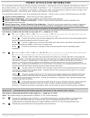 5
5 6
6 7
7PERMIT APPLICATION INFORMATION
On a separate attachment provide the following information. Attachments must be labeled individually as shown in
the sections below. (ie: Physical Surface Water Availability A.1.a) If a section is not applicable, label the section as
Not Applicable or NA. Conclusions, calculations, references, data, and assumptions used must be included in the
application materials. Round flow rate, volume, and reservoir size to tenths.
The applicable addendums must be completed and attached. Check if one or more of the following are included.
Aquifer Testing Addendum – submit with ground water applications
Basin Closure Addendum - Submit for legislative and administrative basin closures
Basin Closure Area - Mitigation Addendum – Submit for ground water application located in legislative and
administrative basin closures
Basin Closure Area - Historic Beneficial Use Addendum – Submit for ground water application located in legislative
and administrative basin closures and the applicant has determined the net depletion will not result in adverse affect
Section A.
Attachments must make specific reference to the section item shown.
PHYSICAL SURFACE WATER AVAILABILITY – ARM 36.12.1702
A.1.
S
G
S
R
– G
TREAMFLOW
AGING
TATION
ECORDS ARE AVAILABLE
AGING STATION RECORDS ARE REQUIRED IF THEY ARE
. A
.
AVAILABLE
LL BOXES MUST BE CHECKED AND INFORMATION PROVIDED
Provide the median of the monthly average flow rates and volumes for the stream gaging station
A.1.a
period during each proposed month of diversion; and
Provide a legible copy or excerpt of the data used, data source, and study or report(s) used in
A.1.b
documenting water availability in the source of supply; and
Provide all conclusions, calculations, data, and assumptions used in estimating water
A.1.c
availability.
A.2.
S
G
S
R
A
N
A
,
.
TREAMFLOW
AGING
TATION
ECORDS
RE
OT
VAILABLE
HOWEVER LOW FLOW MEASUREMENTS WERE MADE
A
T LEAST ONE MEASUREMENT MUST BE COLLECTED DURING THE LOWEST FLOW PERIOD
Provide a table of stream flow measurement(s) taken at or directly upstream of the proposed
A.2.a
point of diversion. The table must include the flow rate measured; all supporting data associated with flow rate
calculations; the date of measurement; a description of the weather conditions, including sky conditions,
whether it is raining or snowing, general wind conditions, and the temperature; the type of measurement
device used , supporting documentation as to the limitations of the device, and its appropriateness for the site;
and the legal land description showing where the measurement was taken.
Provide a table of the median of the average monthly flows for the proposed period of diversion
A.2.b
from the most representative gaging station. Compare the low flow measurements provided in A.2.a above
with the gaging station records.
Using the measured flows from A.2.a above and accepted methods and statistical techniques
A.2.c
for estimating surface water flow rates and volumes, estimate the median monthly flow rates for the water
source at the proposed point of diversion. Provide all conclusions, calculations, data, and assumptions used
in estimating water availability.
If flow measurements could not be taken (such as for an on-stream reservoir), explain why and
A.2.d
provide a drainage basin analysis to show the volume of water available during the proposed period of
diversion. Provide all conclusions, calculations, data, and assumptions used in estimating water availability.
Section B.
Attachments must make specific reference to the section item shown.
PHYSICAL GROUND WATER AVAILABILITY – ARM 36.12.1703
Note: The aquifer testing rule requirements in ARM 36.12.121 must be followed.
Provide the calculated zone of influence. Include the transmissivity, storage coefficient and appropriate
B.1.
analytical model determined from an aquifer test; hydraulic gradient determined from water level
measurements or published water level maps; drawdown cutoff of 0.01 feet; and apply Darcy’s law.
Provide the ground water flow rate through the zone of influence.
B.2.
Application For Beneficial Use Permit, Form 600 ~ R8/2010
Page 5 of 7
ADVERTISEMENT
0 votes
Related Articles
Related forms


/permit")


")


Related Categories
Parent category: Legal