Department Of Transport Oiled Shoreline Assessment Form
Download a blank fillable Department Of Transport Oiled Shoreline Assessment Form in PDF format just by clicking the "DOWNLOAD PDF" button.
Open the file in any PDF-viewing software. Adobe Reader or any alternative for Windows or MacOS are required to access and complete fillable content.
Complete Department Of Transport Oiled Shoreline Assessment Form with your personal data - all interactive fields are highlighted in places where you should type, access drop-down lists or select multiple-choice options.
Some fillable PDF-files have the option of saving the completed form that contains your own data for later use or sending it out straight away.
ADVERTISEMENT
 1
1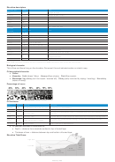 2
2 3
3 4
4Oiled Shoreline Assessment Form
This form should be submitted to the Shoreline Division Coordinator (SC). A summary of the information will be forward by
the SC to the Operations Officer, the Planning Officer and Management Support Unit.
Purpose
Dividing the shoreline
Sectors
This form is for shoreline responders who are required to
Where there is a geographical barrier and restricted
complete a shoreline assessment.
access between two areas, they will be split into separate
It is recommended that such responders have completed
sectors. Different sectors may have separate field
oiled shoreline training as a minimum. This form is not
command centre, catering, ablutions, decontamination,
intended to be used in isolation.
etc. Sectors will be further split into segments.
Safety
Segments
A segment is a piece of shoreline that’s a workable size
Human health and safety is always the number one
for a team and could be defined based on:
priority in any incident.
• Shoreline type
Priorities
• Substrate type
• Access points
Protection priorities under Australia’s National Plan to
• Features e.g. breakwater
Combat Pollution of the Sea by Oil and other Noxious and
• Jurisdiction e.g. shire boundaries
Hazardous Substances (The National Plan) are:
• Presence of particular flora and / or fauna
• Human health and safety
• Distance e.g. every 50 m.
• Habitat and cultural resources
• Rare and / or endangered flora and fauna
Item Category
Item
Check
• Commercial resources
• Recreational and amenity areas.
Recording
Camera
Maps and charts
Complete:
• Take Five; and
Navigation
GPS
• Job Safety Analysis (JSA)
Compass
prior to and as part of your operations.
Mobile phone
What is a shoreline assessment?
Radio
Communication
A shoreline assessment:
Confirm phone / radio
coverage
• is a simple and comprehensive survey of a
shoreline;
First aid kit
• provides data to enable decision making for
Hat
shoreline protection, cleanup and monitoring; and
Sun-cream
• employs a systematic approach using standardised
Personal
Drinking water
terminology.
Rubber boots (non-slip)
What information needs to be gathered?
Wet weather gear
Primary:
Field booklet
• Shoreline description:
• Shoreline type, substrate and energy
Shoreline assessment forms
Documentation
• Biological character of shoreline.
JSA forms
• Oil description:
Log
• Oil location, character and behaviour.
Tape measure
Additional information that may be required:
Other
Shovel
• Access
Sampling kit
• Site hazards and constraints
Ensure you advise command of your planned operation
• Sensitive areas
and establish reporting expectations for while you are in
• Features / landmarks
the field.
• Potential sites for:
• Decontamination / waste;
• Helicopter landing.
February 2015
ADVERTISEMENT
0 votes
Related Articles
Related forms

 Form 4530 - Registration And Amendments Of Foreign Charter Operators Under Part 380 Of The Regulations Of The Department Of Transportation - U.s. Department Of Transportation
Legal
Form 4530 - Registration And Amendments Of Foreign Charter Operators Under Part 380 Of The Regulations Of The Department Of Transportation - U.s. Department Of Transportation
Legal
 Form Stk # 300440 - Notice Of Sale Or Transfer Of A Vehicle - Oregon Department Of Transportation
Legal
Form Stk # 300440 - Notice Of Sale Or Transfer Of A Vehicle - Oregon Department Of Transportation
Legal
 Form Mv-217 - Application For Certificate Of Title After Default By Owner - Pennsylvania Department Of Transportation
Legal
Form Mv-217 - Application For Certificate Of Title After Default By Owner - Pennsylvania Department Of Transportation
Legal
 - Department Of Transportation Forms")


Related Categories
Parent category: Business