African Map Template
ADVERTISEMENT
 1
1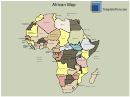 2
2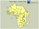 3
3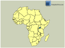 4
4African Map Template
Maps are fully customizable.
• Each country can be individually selected, colored, enlarged, copied, etc
• Countries can be grouped and edited together
• All text labels can be moved, and edited
• Entire Continent can be enlarged or reduced
• Continent can easily be copied to other presentations and a new theme applied
Directions
To
Change Color
•
Select a country (or multiple countries by holding in the „Ctrl‟ key)
•
Click on the Shape fill icon (a bucket) that will be available on the Home and Format
panes on the Ribbon in PowerPoint
Select the desired color for the selected Country/Countries
•
To Change Size of Continent
•
First edit the map to your preference – (recommend working on slide 4)
•
Remove unnecessary text labels – (Already done on slide 4)
•
Select entire continent by pressing „Ctrl‟ and „A‟ keys together
Right click on one of the highlighted boxes and select Group
•
Resize grouped picture by clicking and holding on the corner of the image
•
•
Right click on image and “ungroup” to make further edits (adding labels etc)
ADVERTISEMENT
0 votes
Related Articles
Related forms


Related Categories
Parent category: Life