Data Form For Terrestrial Mollusk Site Surveys Page 2
ADVERTISEMENT
 1
1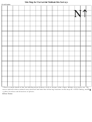 2
2 3
3 4
4Site Map for Terrestrial Mollusk Site Surveys
Grid Scale:
Ν
↑
* Draw a rough sketch of the site labeling major features such as streams, talus slopes, habitat cover types, etc. Be
sure to indicate where animals were detected and label the following locations on the map: G = GPS reading, and P
= photo locations and directions of photos.
Other Notes:
ADVERTISEMENT
0 votes
Related Articles
Related forms


Related Categories
Parent category: Business