'Interpreting Weather Symbols - The Visual Language Of Weather' Geography Worksheet Page 2
ADVERTISEMENT
 1
1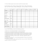 2
23. Fill in the blank spaces next to each city with the correct values.
For the following cities: Atlanta, Chicago, Dallas, Denver, Miami, Minneapolis,
New York, San Francisco, Seattle, Washington—and your location if not listed!
CITY
STATE
TEMP.
DEW POINT
WIND SPEED
WIND
AIR
CLOUD
DIRECTION
PRESSURE
COVER
Atlanta
GA
Chicago
IL
Dallas
TX
Denver
CO
Miami
FL
Minneapolis
MN
New York
NY
San
CA
Francisco
Seattle
WA
Washington
DC
OUR TOWN
In your WEATHERlogs, answer the following questions:
4. Which city is recording the highest current temperature?
5. Which city is recording the lowest current temperature?
6. Describe the location(s) of high pressure centers and low pressure centers.
7. Describe the direction of wind circulation around any high pressure centers.
8. Describe the direction of wind circulation around any low pressure centers.
9. Describe the location(s) of warm fronts, cold fronts, stationary fronts, or
occluded fronts.
10. Which areas of the U.S. are receiving precipitation? Where is the heaviest
precipitation occurring?
11. Locate the nearest surface reporting station near your school. Describe the
weather conditions at that station.
ADVERTISEMENT
0 votes
Related Articles
Related forms


Related Categories
Parent category: Education