Form Eia-7a - Annual Survey Of Coal Production And Preparation Page 8
ADVERTISEMENT
 1
1 2
2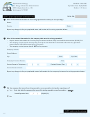 3
3 4
4 5
5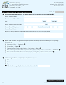 6
6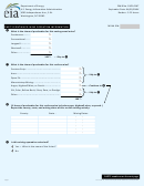 7
7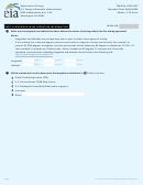 8
8 9
9 10
10 11
11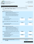 12
12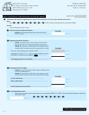 13
13 14
14 15
15 16
16Department of Energy
OMB No. 1905-0167
U.S. Energy Information Administration
Expiration Date: XX/XX/XXXX
1000 Independence Ave., S.W.
Burden: 3.25 hours
Washington, DC 20585
MSHA ID#:
PART 3 CONTINUED: MINE OPERATION INFORMATION
❿
What are the longitude and latitude that best defines the center of mining activity for this mining operation?
Notes:
Longitudes and latitudes may change from year to year to reflect the progress of mining.
If the readings are in decimal degrees, please convert them to degrees, minutes and seconds. For example, to
convert 82.4536 degrees to degrees, minutes and seconds, do the following: 82 degrees multiplied by 27.216 = 27.
Then multiple 27 minutes by 12.96 seconds = Mine’s location at 82 degrees, 27 minutes and 13 seconds.
Complete instructions for estimating longitude and latitude can be found at the following link:
Degrees
Minutes
Seconds
Longitude:
Degrees
Minutes
Seconds
Latitude:
⓫
Which method was used to determine the longitude and latitude in
? Select only one.
❿
Global Positioning System (GPS)
U.S. Census Bureau TIGER Map Service
U.S. Geological Survey MapFinder ( )
Unknown
Other:
Page 8
Form EIA-7A, Annual Survey of Coal Production and Preparation
ADVERTISEMENT
0 votes
Related Articles
Related forms
 Form Ld-t - Annual Report Of Premiums,taxes And Fees Of Foreign Life And Accident And Health Insurance Companies - 2011
Financial
Form Ld-t - Annual Report Of Premiums,taxes And Fees Of Foreign Life And Accident And Health Insurance Companies - 2011
Financial
 Form Rrg-t - Annual Report Of Premiums,taxes,and Fees Of Registered Risk Retention Groups - 2011
Financial
Form Rrg-t - Annual Report Of Premiums,taxes,and Fees Of Registered Risk Retention Groups - 2011
Financial


 Form 306t - Allocation Of Coal Employment And Production Incentive Tax Credit Between Interested Parties - 2008
Financial
Form 306t - Allocation Of Coal Employment And Production Incentive Tax Credit Between Interested Parties - 2008
Financial
 Form 306t - Allocation Of Coal Employment And Production Incentive Tax Credit Between Interested Parties
Financial
Form 306t - Allocation Of Coal Employment And Production Incentive Tax Credit Between Interested Parties
Financial


Related Categories
Parent category: Legal