Aquatic Farm Application Form - State Of Alaska Page 7
ADVERTISEMENT
b. The location and distance from your site.
c. The name of the discharger(s), if known.
5. Are you aware of any other planned development in the general area of your proposed farm? Yes
No
If yes,
describe the planned development.
G. SITE PLAN & PHYSICAL DESCRIPTION
THE FOLLOWING INFORMATION MUST BE INCLUDED WITH YOUR APPLICATION. YOUR APPLICATION WILL BE
REJECTED IF ANY OF THE INFORMATION IS NOT INCLUDED.
Four types of maps/drawings and photographs are required to make your application complete, are further described
below, and include: 1) a vicinity map; 2) a site plan; 3) a cross-sectional diagram; 4) a detailed drawing, and 5) an 8” by
10” photograph of each component of your application, i.e. growout area, hardening area, etc. All drawings must be on
8½" x 11" paper.
Please check off each item below as you complete each requirement.
1. Vicinity Map
a. Provide a Vicinity Map using a U. S. Geological Survey (USGS) topographic location map. Map Name:
(e.g. Seldovia B-4)
Use a 1" = one mile (1:63,360) USGS topographic map. Indicate the location of your proposed farmsite and the
location of any upland components. (Refer to Section C.2.)
b. National Ocean Survey Nautical Chart #
. Indicate the location of your proposed farmsite. (Refer to
Section C.2.)
c. Indicate the distance and direction to the nearest community from your site. ( e.g.: Petersburg, 25 miles north, Ketchikan,
30 miles southwest, etc.)
2. Site Plan
Provide a Site Plan drawn to scale, which shows the layout, location, and dimensions of the following items within your
proposed farm boundary. (A sample Site Plan is provided for reference.)
a. Indicate the boundaries of the farm area for all proposed uses of tide/submerged lands and uplands. (All anchors must be
inside your boundary lines.) Indicate, in feet, the dimensions of each boundary line - multiply the width by the length to
make sure the amount is equal to the area or number of acres requested (one acre=43,560 square feet). Hardening and
defouling areas are part of the farm site but may be outside the primary farm boundaries.
b. Identify CORNER NUMBER 1 (northeast corner) of each parcel/component that was used for the latitude and longitude
coordinates in Section C.4.
c. The workrafts or other production facilities to be employed.
d. Anchoring systems. (Include anchor type and weight, diameter and length of anchor lines, proposed anchor scope.)
e. Docks, floating structures, caretaker facilities - including upland or tideland.
f. Wastewater disposal systems, including both sewage and grey water discharge points (grey water means domestic
wastewater from laundry, kitchen, etc., which does not contain human waste).
g. The location of water, including any drinking water wells or other drinking water system sources, fresh water, and salt
water, within 200 feet of the proposed wastewater disposal system.
h. Solid waste storage and disposal sites (note: you are encouraged to use existing permitted sites for the disposal of solid
wastes).
i. Roads or airstrips.
j. Other upland or tideland facilities at the site associated with the farming operation.
k. Fuel and chemical storage.
l. Properties referenced in Section B.7. (adjacent property owners)
Page 7 of 7
10/98
Revised 12/00
ADVERTISEMENT
0 votes
Related Articles
Related forms
Related Categories
Parent category: Legal
 1
1 2
2 3
3 4
4 5
5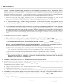 6
6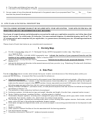 7
7 8
8 9
9 10
10 11
11


