Open Ocean Lesson Plan And Activity Page 3
ADVERTISEMENT
 1
1 2
2 3
3 4
4 5
5 6
6 7
7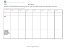 8
8Partnerships for Reform through Investigative Science and Math
Open Ocean is anywhere offshore (outside the reef) where you can’t see the bottom (water is
greater than 150 feet deep).
On chart paper, discriminate between some biotic (living) and abiotic (nonliving) characteristics
of the open ocean. Examples include biotic = fish, whales, plants while abiotic = ships, waves,
salt in water. Try to limit the brainstorm to 10 minutes, because it is easy to get sidetracked.
Make sure everyone has an idea of what the open ocean is.
2. Group Map Walk (20 min)
Explain that the maps show satellite pictures/data of physical (abiotic) features of the open ocean.
You should reveal (write on board) that these are 7 maps of physical (abiotic) characteristics of
the open ocean, two are of bathymetry (depth), and there is one each of salinity, temperature,
nutrients, currents, and wind. Draw attention to the key of each map as a clue to what that map
displays.
Explain the procedure of the worksheet. Students should hypothesize what each map
shows and why. For example, Map 1 shows depth because the water gets a different color the
further away from shore you go. Remind students that there are two maps that show water depth.
Break the class into groups and have each group start with a different map (3-4 members per
group). Scaffold students if needed.
3. Revealing the Maps (20 min)
Have students explain what they think each map is and why. Reveal each map and explain
briefly how each characteristic is important and how the students may identify each map in the
future. Explain the keys as needed. NOTE!! These maps, with the exception of
depth/bathymetry, show the ocean at one period of time or an average! Currents move,
temperatures change, and nutrients get used up! This means that the ocean is constantly
changing. Also these maps show the surface of the ocean. This concept will be important for the
next lesson.
Map 1: Bathymetry of Hawaii
This map shows the depth or bathymetry of the ocean bottom around Hawaii. The depth of the
ocean is very important to what type of organisms live in those areas. The islands are shown in
gray. Any area in red is probably shallow enough to support some coral. Notice how fast the
ocean gets deep off of Kona. This is why we have so many large fish so close to shore here.
Map 2: Bathymetry of the Pacific
This map shows the depth or bathymetry of the ocean bottom throughout the Pacific Ocean.
Make sure the students note where Hawaii is and how far away we are from other land. The key
is broken into light blue areas that are less than 500 meters deep and dark blue/black areas that
are deeper than 500 meters. Note the shallow areas close to land and the deep areas such as
trenches.
Map 3: Nutrients
This map shows the nutrient levels of the Pacific Ocean. Nutrients are measured by the amount
of chlorophyll that plankton or other plants produce. The higher the chlorophyll produced the
higher the amount of nutrients. Land masses are shown as green or yellow because they have a
Lesson 1: The Open Ocean
3
ADVERTISEMENT
0 votes
Related Articles
Related forms


 And (2-4 Grade)")


Related Categories
Parent category: Education