Open Ocean Lesson Plan And Activity Page 4
ADVERTISEMENT
Partnerships for Reform through Investigative Science and Math
lot of plants. Oceans have lower nutrient levels and are shown as green to purple. Anywhere
that has high nutrients in the ocean is usually a place with a lot of productivity and lots of living
organisms. Nutrients are measured in milligrams per cubic meter of water. A cubic meter is
about the amount of water in a full bathtub.
Map 4: Salinity Map
This map shows the different areas of the ocean in terms of salinity or the amount of salt. There
is less salt in the surface water at the poles of the world. This is because salty water is heavier
than fresh water, and when it cools in the polar areas it sinks to the bottom. This will be
demonstrated in the current labs. Salinity is measured in PSS which stands for Parts of Salt per
Sea water. The lower the PSS, the less salt. Hawaii is shown as empty white dots in the middle
of the Pacific. Hawaii has fairly salty water around it.
Map 5: Sea Surface Temperature (SST)
This map shows the average temperature at the surface of the ocean throughout the world.
Temperatures are in Celsius. Note: Hawaii is close to the red, yellow, and green areas. This
means that Hawaii may have different sea-surface temperatures throughout the year. Areas
where waters of different temperature meet often stimulate high productivity.
Map 6: Visible Hawaii/Hawaii’s Wind
This map shows a photograph of Hawaii from space. The white lines are clouds (look at the
Kohala Mountains). Note how the clouds show how the winds push air through the islands from
the north to south. Winds also push the ocean water to create currents. The area west of Kona
shows how the sun reflects off the smooth water like a mirror just like if you use a flash camera
in a mirror.
Map 7: Currents
This map shows some currents in the Western Pacific Ocean. Hawaii is on the far right side of
the map. The currents are measured in how fast the water is moving. Note that these current
patterns (swirls) will look like the colored currents in the lab.
nd
2
Period: What do currents bring, and how does the open ocean change?
Currents are the oceans highways. They move different types of seawater from place to place.
Currents may mix this water or remain separate. Currents also carry living organisms and the
nutrients these organisms need to survive. In this section students will predict and observe what
happens when salt meets fresh water, or when cold water hits warm water. How do these
experiments relate to the student’s real world experiences?
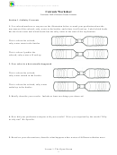
Currents: Multiple stations with Hot vs. Cold water, Salt vs. Fresh water. Here, we are focusing on
the student's experiences in Hawaii and tying those in with the lab.
Temperature Current Station
1. Fill one bottle to the top with hot tap water.
2. Screw the tornado tube onto the hot-water bottle.
3. Fill the other bottle almost to the top with icy cold tap water.
4. Add six drops of food coloring to the cold bottle.
Lesson 1: The Open Ocean
4
ADVERTISEMENT
0 votes
Related Articles
Related forms
Related Categories
Parent category: Education
 1
1 2
2 3
3 4
4 5
5 6
6 7
7 8
8


