Attendance And Participant Good Faith Estimate Page 11
Download a blank fillable Attendance And Participant Good Faith Estimate in PDF format just by clicking the "DOWNLOAD PDF" button.
Open the file in any PDF-viewing software. Adobe Reader or any alternative for Windows or MacOS are required to access and complete fillable content.
Complete Attendance And Participant Good Faith Estimate with your personal data - all interactive fields are highlighted in places where you should type, access drop-down lists or select multiple-choice options.
Some fillable PDF-files have the option of saving the completed form that contains your own data for later use or sending it out straight away.
ADVERTISEMENT
 1
1 2
2 3
3 4
4 5
5 6
6 7
7 8
8 9
9 10
10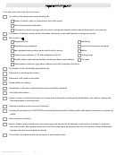 11
11 12
12 13
13 14
14 15
15 16
16 17
17 18
18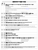 19
19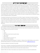 20
20 21
21 22
22 23
23 24
24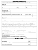 25
25 26
26 27
27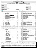 28
28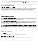 29
29 30
30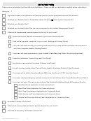 31
31 32
32SITE PLAN/ROUTE MAP
Your site plan/route map should include:
An outline of the entire event venue including the
Names of streets, parks or areas that are part of the venue.
The lot lines/property boundaries
If the event involves a moving route of any kind, indicate the direction of travel and all street and/or lane closures
The location of fencing, barriers and/or barricades. Indicate any removable fencing for emergency access
The location of all
Stages/platforms
Scaffolding
Bleachers and grandstands
Tents and all temporary structures
Beer gardens/locations where alcohol will be sold or served
Booths
Trash/recycle containers (T, R) and dumpster/roll-offs (D)
Cooking areas
Portable toilets, hand washing facilities, drinking fountains, water stations
Fire Lanes
Waste grease containers, gray water containers and other temporary structures.
The location of first aid facilities and ambulances
Placement of vehicles and/or trailers
Placement of all vendors and booths
Space allotted for parking
Identification of all event components that meet accessibility standards
Lost child booth location
A detail or close-up of the food booths and cooking area configuration including both identification of all vendors cooking with
flammable gases or barbeque grills
Generator locations and/or sources of electricity
Access and exit locations for OUTDOOR events that are fenced and/or locations within tents and tent structures, to include exit
widths
Firework launch location(s)
Security. Please clearly indicate each area where approved security will be deployed, including but not limited to: entrances
and exits to event, beer garden entrances and exits and placement along barricades and road closures. Please differentiate
between volunteer and professional security
The number of professional security personnel at each street closure
Updated December 23, 2011
10
ADVERTISEMENT
0 votes
Related Articles
Related forms
 - Oak Tree Funding")


 - Required Form")


Related Categories
Parent category: Business